Friday, September 01, 2006

ESRI International User Conference


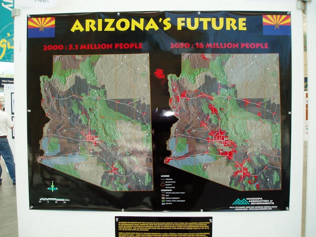
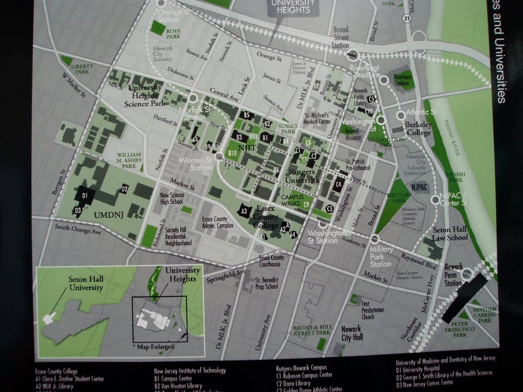
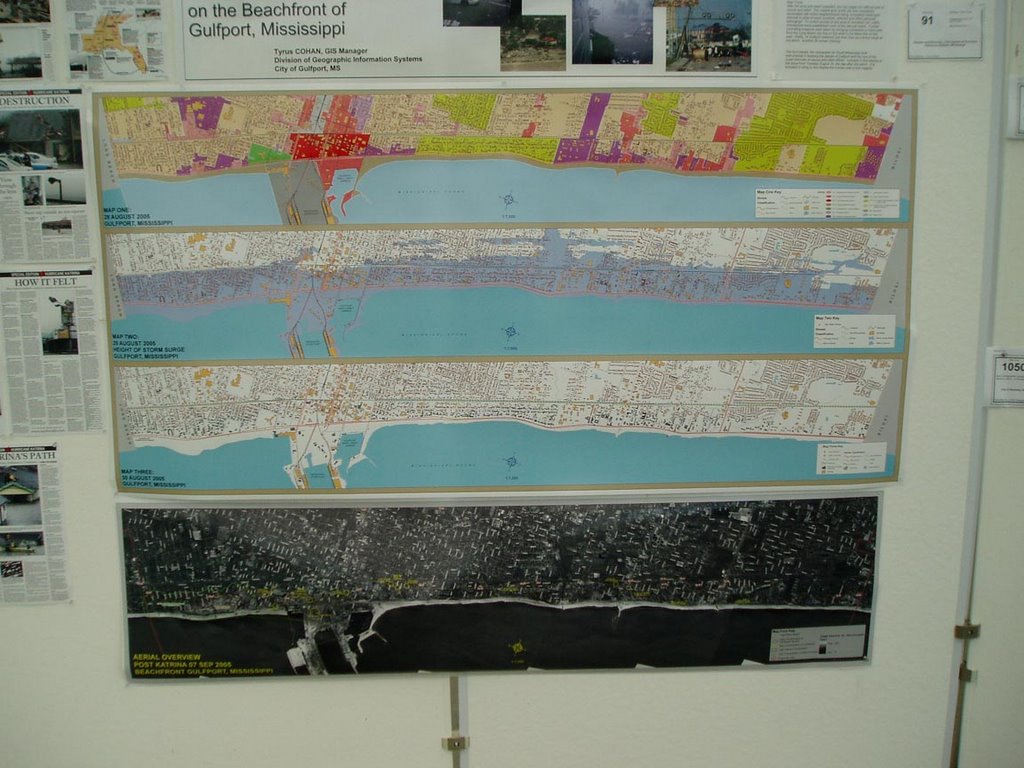
As I mentioned in an earlier post, the primary motivation for our trip to San Dieigo was the ESRI International Use Conference, which is put on annually by the maker of the most commonly used commercial GIS software, ArcGIS. I use ArcGIS almost every day at CommEn Space and have been using ESRI products in some form or another for 10 years. The conference was great fun. I always learn new things and gain great inspiration from the Map Gallery. This year was no exception. There were several outstanding sessions, which I describe in some detail below for any readers who happen to be similarly interested in spatial data and analyttical methods, and I'm also including some digital pics of a few of the maps I found particularly intriguing.

Here's a brief rundown on the sessions I attended. Please pardon the rough nature of the notes, most of them were hammered out on my laptop in real time.

Status of NLCD

NLCD has two other products in addition to the landcover--percent impervious and percent tree canopy. The USGS has been using See5 for the classifcation tree; it is highly automated and will enable easily automated updates of national land cover. The canopy cover data set is complete for lower 48; moving on to AK next . Imperviousness is also done for most of the US

For landcover, by end of 2006 most of the lower 48 will be done

Download data here:

gisdata.usgs.net/website/MRLC

www.mrlc.gov

Spatial techniques for Marine Reserve selection
Brian Fulfrost

Ailinginae island--several uninhabited coral attols

Rapid ecological assessment --30 field sites; terestrial bird surveys

Remote sensing on benthic habitat, bathymetry, and vegetatoin changes using quickbird imagery

35 dive sites; somewhat biased locations due to remoteness

Question is how to protect attols biodiversity

Coral
Fish
Birds
Rare species
Range extensions

Derived bathymetry from Quickbird (Daria Siciliano) and also derived benthic classifiation--apparently many papers written on her methods (speaker

NDVI vegetation change analysis

Methods used are: Kriging, regressions, MARXAN (simulated annealing algorithm)

Kiriging: interpolate species richness from sampled points; interpolation from the points, so the surfaces were not very useful because of low N; doesn't look into currents, suitable substrate for larval settlement, etc, also doesn't incorporate ecological barriers (but Constantine @ ESRI has worked out some ways around that)

Regressions: N is too small, so regression has no significance

MARXAN: combines field data w/remote sensing.
1. Planning units
2. Conservation targets
3. Boundary length modifier (looks at adjacency issues)
Used hexagons across the islands
Targets:
Looked at sum irreplaceability--any poly chosen more than 50% of the time represent irreplaceable areas

Best fit model gives you the best output to meet your conservation targets.

MARXAN is not an "ecologically intelligent" tool, it's a decision making tool.

Combine techniques to get the best fit

The influence of Topography on Habitat Area Estimates
Duane J. Haselfeld

PSOMAS--consulting firm in CA

Basic idea here is there is, in some instatnces, a huge discrepancy between plannimetric area and topographic area

The relative increase in the topographic area is directly proportional to the slope--the steeper a place is, the less accurate area measurements will be

At 60 degrees, the error is approx 100%; the error is very low where slope is low, but it increases rapidly--

0-25 degrees, 10% error
25-40 degrees, 30% error
40-60 degrees, 100% error

Emphasizes that elevation is not a surrogate for slope.

Pretty interesting; bottom line is that when area calculations are important, use the topographic area and not the planimetric area


New Landcover Data for the State of Maine
Sanborn office in San Diego

Andrew Lewis worked on the landcover map of Maine

Mike Smith from State of Maine
Mike Palmer from Sanborn in the Ann Arbor office

Project is moving form a 30m to a 5m data layer

Collaborative effort with Maine

Integrated with Federal NLCD/CCAP 2001 projects

Modeling wildlife habitat
Water quality
Imperviousness
Broad level planning initiative

Lots of partners on the project--Federal, state agencies, some non-profit? (Woodlot Alternatives was employed as the field data gathering arm)


Deliverables: 5-meter landcover, based on the NLCD 2001 landcover data classes

5-meter imerviousness data for about 25% of Maine

Recylced a lot of work from the NLCD work


Used SPOT panchromatic; semi-automated approach to binary impervious

Resulting products are CCAP, 5m polygon based map (not as interdigitated landcover classes)

Ran image segmentation on SPOT 5 to get the landcover classes

USed E-cognition for segmentation

Used training data based on the change classes (I think on some field work too)

RFeferred to as a "low cost" option--but how much did it cost?
He mentioned that they're doing some stuff with 1m resolution data

$125k for the SPOT imagery
$100k for the analytical work

Pan sharpening was done in ERDAS Imagine

Energy Mapping in Austria

Because of direct o indirect solar production, increasingly huge land areas are necessary for energy production. Energy will soon be readically impacting zoning throughout the developed world.

Demand indicators:
• Demographics
• Business data
• Using standardized load curves from utilities

1. Demand forecast
2. Potential Generation forecast: concept is a “virtual powerplant” of different types of renewables; transmission doesn’t’ send energy over long distance,s mostly provides stability to the entire network
3. Looking for a locally adapted mix of appropriate renewable energy sources

Look at segmentation for defining homogeneous regions froma grid—looks a bit like thiessen polys; “autoarkic regions”

Equitable Fee Collection Using Enhanced Impervious Surface Data
Lauri Sohl, City of Sioux Falls

All properties in SD are charged a storm drainage fee based upon impervious cover per parcel. Impervious surface includes roads, parking lots, etc

Parcel area X runoff WT factor X unit financial charge

Runoff factor is determined by land use, based on intensity of use

METHODS:

Orthophoto 6” resolution
Infrared IKONOS 4m

Resolution merge using Leica Geosystems Image Analysis Extension; used Borvey transformation, nearest neighbor resample

Feature Extraction by Visual Learning Systems (an extension)—VLS Feature Analyst

Create “learning” feature class.

Conservation Plan for Southeast Pennsylvania
Clare Billet, Smart Conservation, smartconservation.org

***VERY INTERESTING presentation. Looked at terrestrial vertebrates, grid-based from GAP. For aquatic resources, used the watershed. For Terrestrial resources, used GAP and heritage for Rarity (how did they solve the absence of absence problem?)

Focused on top 20% as nodes

Used roads, railways, streams, waterbodies, as barriers for the network analysis

Web-site supports on-line digitizing, analyzes how important that site is, online—pretty amazing

Identifying, Defining, & Mapping Natural Infrastructure in SW Pennsylvania
Andrew Schwartz, Environmental Planning & Design, LLC

Landscape Characterization & Evaluation of Alachua County FL
Partnered with the Information Center for the Environment (ICE) @ UC Davis

Tuesday, August 29, 2006

San Diego


Earlier this month we went to San Diego. I was attending (and presenting at) the ESRI International User's Conference, so Amy and the kids flew down too and we rented a condo in Encinitas, a few blocks away from Moonlight Beach. Encinitas is an awesome beach town, very walkable with lots of restaurants and best of all the Coaster stops right in the middle of town, which is how I got to the conference each day. (I did manage to fit in some beach days and a trip to Legoland with the fam).

My brother drove over from Flagstaff mid-week to hang out with the kids, and he came to the conference with me on Thursday to watch me present, visit the map gallery, and check out some other sessions. The presentation went pretty well--it was about a conservation plan I've been working on for the Columbia Land Trust.

The second weekend of our stay was also Liam's 3rd Birthday, so both sets of grandparents came over from Phoenix, along with Amy's sister Julie and her daughter Madison. It was a great birthday party for Mr. Little Guy and we were elated that he was able to celebrate with so many of his relatives--actually, just about all of his relatives!

Back from the Summer

Well that was a nice month and a half off from blogging. Where the heck was I, you might ask? Well:

a) We went to San Diego for 10 days (more on that soon)
b) I've been working on the side for The Watershed Company
c) CommEn Space is losing another staff member

More on b) and c) sometime soon too.

Oh yeah, and raising two kids is REALLY TIME CONSUMING. But also really fun too.

Tuesday, July 18, 2006

Pacific Crest Trail


We finally made it out for a hike in the Cascades. We walked along the Pacific Crest Trail for a couple of miles with the ostensible destination of Commonwealth Basin, but everyone got tired before we made it so we turned back. It was a wonderful day in the forest.

2 Months Old


Lochlan is two months old today!

Kentucky


Yes, we went to Kentucky for the 4th of July. Why? Amy's mother's family is from Louisville, and the Faust's were having a reunion. Linda really wanted her whole family to be there, so she and Dan generously offered to fly everyone out for the big event.

Kentucky in July is pretty hot (94 degrees) and pretty humid (85-100% humidity most days). However, we did not let that stop us from having barefoot races in Carol & Bill's enormous backyard! Their house was built on part of what used to be the hay meadow of a big farm. The kids loved the rural feel of the area, with the ponds, fields, tractors, and (my personal favorite) fire flies, Pyractomena sp.

In addition to the family reunion, we also visited a farm in Indiana and went to the Six Flags in Louisville. We definitely had some fun moments, and I know Liam had a blast playing with his cousins, but it was pretty bracing for us to be in Kentucky--Amy and I felt like fish out of water most of the time. (I'm speaking here of Kentucky generally, not how we felt around Amy's relatives, who are all lovely people).

In any event, I'm glad we went, but it sure felt good to come home.

Wednesday, July 12, 2006

Two Articles on the Climate Crisis in Local Papers

I'm reading Tim Flannery's book The Weather Makers right now, so perhaps I'm a bit more alert to the presence of these stories, but it seems like the local news media is really starting to focus on what's happening to our atmosphere. Here are two recent articles from the Seattle Times:

West Coast climate change could threaten wine production, study suggests

and

Global warming: They're not laughing at Ron Sims now

Some choice quotes from each article, respectively:

"We say you will have a wonderful experience at Safeco or Qwest Field," Sims jokes, "because you'll be able to fish from the stands."

The West Coast would experience one of the biggest changes in season, resulting in a significant alteration to the quality of its grape harvest. Suitable grape-growing areas in California would shrink to a narrow coastal band, the researchers said, while premium wine-grape areas would shift into the Pacific Northwest and New England.

Hopefully, as Flannery predicts, the climate crisis will become THE issue, and we will continue to see stories like this every day--to the point that everyone begins to take the problem seriously enough to act.

Monday, July 10, 2006

Excellent Documentary on Peak Oil

Leave it to Australia (the only country in the world that uses more oil per capita than the U.S.) to produce an amazing documentary on Peak Oil. Even better, you can watch it for free on the web, here.

As one of my profs from grad school, Donald Miller, used to say, "When a thing is unsustainable it tends to stop."

Accident Follow-Up

Sadly, the driver of the car that rear-ended us died:

Seattle man dies in traffic rear-ender near Gardiner
A two-car accident Saturday afternoon on U.S. Highway 101 near Gardiner claimed the life of an 88-year old Seattle man, with minor injuries to two of the other four people involved.

According to the Washington State Patrol, about 4:08 p.m. June 24 a 1991 Mercedes two-door was trailing a 2004 Toyota Matrix southbound on Highway 101 approaching Orcas Road, milepost 280 near Gardiner.

The Toyota reportedly stopped for traffic, and it was rear-ended by the Mercedes driven by Norman R. Cole, 88. Mr. Cole was airlifted to Harborview Medical Center in Seattle, where he died that evening.

His car had three passengers. Jessica Weber Cole, 38, and Payten A. Stewart, 7, were transported to Jefferson Healthcare Hospital in Port Townsend for sore backs. Nicole S. Thomas, 15, was not injured but was transported to the hospital as a precaution, according to the State Patrol.

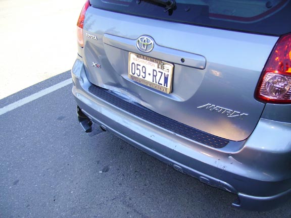
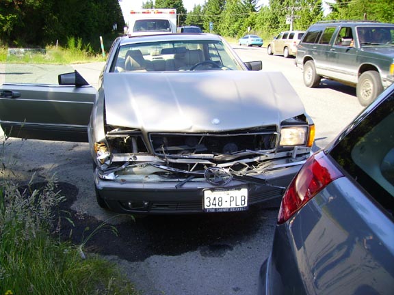
Amy L. Stevenson, driver of the Toyota, was not injured. Her vehicle sustained minimal damage and was driven from the scene. The Mercedes sustained an estimated $2,000 in damage and was towed.

The State Patrol lists the accident as under investigation.


Very, very sad, especially for his daughter and granddaughters. Fortunately, we are all OK--the article erroneously reports that Amy was the only passenger in our car. Also, the "minimal damage" to our car is going to cost over $6,000 to repair. Fortunately, Mr. Cole's insurance is covering everything.

Sunday, June 25, 2006

Great Day on the Peninsula Marred by a Horrible Accident


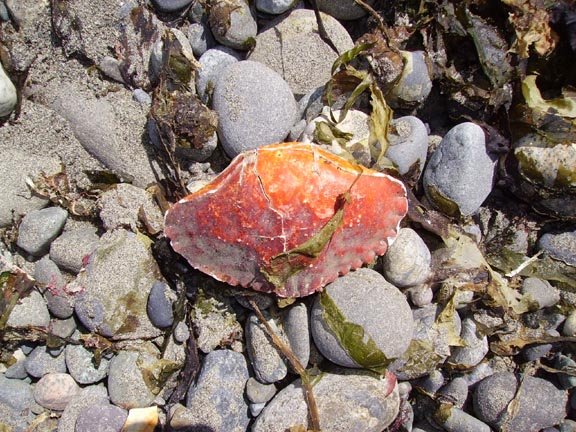
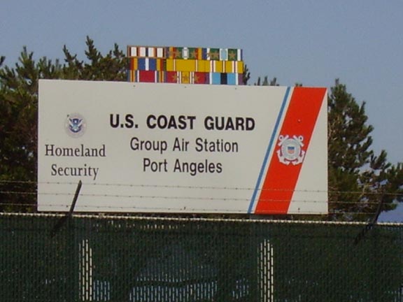
On Saturday we took a road trip to the Olympic Peninsula. The weather was absolutely gorgeous, and we got an early start, miraculously catching the 8:45 ferry to Bainbridge Island. We saw a peregrine falcon and an osprey circling around each other as we crossed the Agate Pass, and had lots of beautiful views of the mountains and Sound. Our ostensible destination was the Coast Guard air station at Port Angeles (Liam is really, really into all things Coast Guard lately, especially helicopters) but mostly we just wanted to get out of the city. The Little Guy and MicroMan were getting kind of restless, so we stopped at the Dungeness Spit just west of Sequim. We walked the beach, put our toes in the surf, and Liam and I caught a bunch of crabs in the tidepools on the east side of the spit. It was awesome. After a quick picnic, we continued east to Port Angeles.

The air base was pretty cool--it is at the far end of Ediz Point, which is another spit similar to the Dungeness, but unlike the wildlife refuge, this one has been heavily developed. In any event, they do not allow tours unless they've done a background check, and in any case they don't do them on the weekend. We were fortunate to see one of the Dolphin helicopters take off, and the security guard was extremely cool--he let us watch it take off from inside the base, which he wasn't technically allowed to do. He also gave Liam some candy and a "collector's card" showing one of the Pt Angeles Dolphins in action.

We loaded the boys up, re-stocked our water, caffeine, and snacks, and headed for home. Both boys zonked out in their car seats around 3:30, and we drove for about another half hour, talking with each other, and just enjoying the scenery.

That's when the accident happened.

We were heading south on 101, and Amy was driving. Suddenly, she had to put the brakes on hard--a white car, two vehicles in front of us, stopped very suddenly to turn left. The vehicle in front of us stopped in time, but Amy did not want to lock the brakes and wake the boys. So she pulled over to the shoulder, and we stopped adjacent to the car that was in front of us. The white car that was turning left completed the turn, and we were just about to continue on our way, when suddenly--BAM!!! We were rear-ended, hard. We could hear glass hitting the pavement and various pieces of debris falling around us.

Amy and I looked at each other, trying to process what had just happened. She pulled forward to get us across the intersection, and we both jumped out of the car to check on the boys, both of whom were now crying. They seemed fine--Liam said he was OK, so I left him in his seat to keep him away from traffic, and Amy took Lochlan out of his seat to check on him. I looked at the other vehicle, a two door Mercedes, which was totaled. The driver was an old man, and he kept saying he was sorry. He had three passengers--his daughter and two granddaughters. We made sure they got out of the vehicle and off to the side of the road, and then we exchanged information. A volunteer EMT who worked at the resort on the other side of the road came over to help. He phoned 911 and started checking everyone over. Before long there were 3 ambulances on the scene. Fortunately, our family was fine, but the passengers in the other vehicle had some injuries. After about 15 or 20 minutes, the old man (named Norman) sat down in the passenger seat of his car. He called out to the paramedics, and said he was experiencing some chest pain. Very shortly thereafter, maybe 30 seconds, he became unresponsive, and the paramedics and EMTs sprang into action. First they moved him out of his vehicle onto a stretcher, and we could see that he had lost control of his bowels. He did not appear to be breathing. All of this was happening in front of his daughter and granddaughters, who were understandably freaking out. By this time a WA State Patrol trooper was on the scene, and he tried to keep them calm, but it was pretty horrible. We learned later that he was airlifted to Harborview in Seattle, and probably did not make it. The doctor that we spoke with when our family was checked out said that he was 88 years old, he most likely had a ruptured aorta, which is very difficult to recover from.

Fortunately, our family was just fine, and our car was still driveable, so they released us from the hospital and we took the Kingston-Edmonds ferry. It was a long night, and we were all really sore and tired, but thankfully, uninjured.

Car accidents suck.

Father's Day


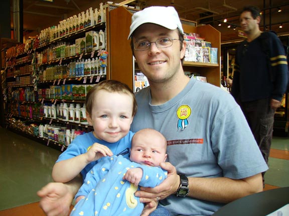
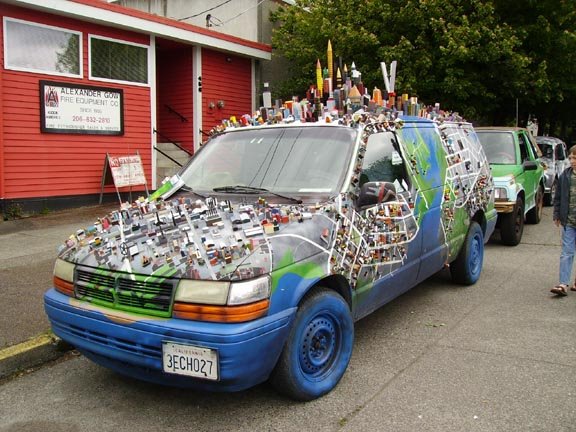
We had a great Father's Day this year--it coincided with the Solstice Fair, so we attended the parade on Saturday and checked out the Fair on Sunday. We grabbed a bite to eat at PCC, toured the art cars (here's a pic of my favorite) and took in lots of live music (they had at least 3 stages going simultaneously!). Liam & Lochlan gave me a card--with a little help from Amy--that included some stickers, one of which is affixed to my shirt. I really love being a Dad.

Thursday, June 22, 2006

Fremont Bridge Approach Replacement Project Update


Things are progressing nicely on the Fremont Bridge project. They've closed off the eastern half of the bridge and torn down that half of the approaches. Consequently, all pedestrian and bike traffic has been shifted to the remaining walkway on the west side of the bridge, and it seems to be working pretty smoothly. It's only bad after a bridge opening, when there are dozens of peds and bikes trying to make it through the choke point on the north end of the bridge.

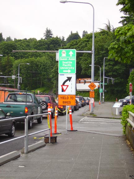
The best part of the construction is they are starting to implement some of the designs suggested by the Citizens' Advisory Group. It was particularly gratifying to see this sign, which is very close to the sketch that I made for the Parsons-Brinckerhoff engineers at one of the meetings two summers ago (the main difference is my drawing had a bicyclist in the middle of the yield sign). I knew there was a reason I was spending so much time under the artificial lights on those beautiful July days!

The Amazing Flying Toddler


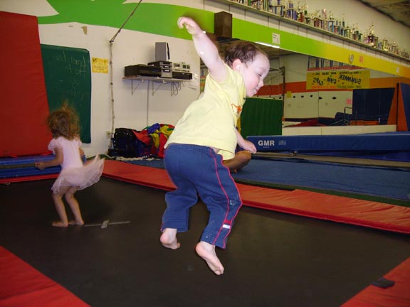
While on paternity leave I went to Liam's gymnastics class. The boy can jump! (Kinda hard to tell in the photo, but he's about 2 feet in the air)

Holy Baby-Induced Time Vortex, Batman!


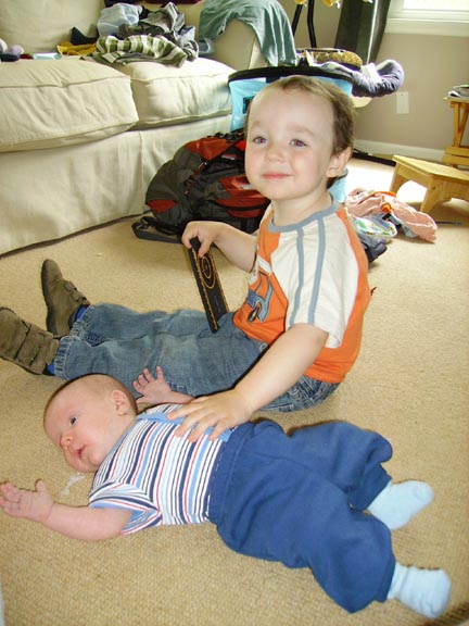
My goodness it takes a lot of energy (and TIME) to work forty hours a week and be an engaged parent of two boys, especially when one of them is just over a month old. Hence, the very light blogging since MicroMan (aka Lochlan) came on the scene. I shall try to remedy that, starting today! Here is a recentish photo of the wee lad, and another of the dynamic duo in the living room. My favorite part about the second photo? It almost looks like Liam pressed down on Lochlan, resulting in the dollop of goop that exited his mouth right before I took the picture. Sweet!

Tuesday, June 06, 2006

Bike to Work Day


Bike to Work Day happened the day after Lochlan was born. Obviously, I was not going to go to work, but Liam was awake and really wanted some attention from Mom. However, she really, really needed some uninterrupted sleep, so I packed up the boy on the Co-Pilot and we pedaled to the BTW festivities on the south end of the Fremont Bridge. It was a pretty impressive turnout, and I think it was exciting for Liam to see so many people on bikes in a familiar neighborhood. David Hiller spoke, and at the end of his remarks, he introduced our State Senator Jeanne Kohl-Welles who talked about cycling with a refreshing level of familiarity (in fact, she told the assembled crowd that she's even completed the Seattle-to-Portland ride!) and I was heartened to hear her point out that her district has the highest number of bicycle commuters in the entire state, and she expressed her continuing support for generously funding bicycle and pedestrian transportation projects in the district.

The best part of the morning for Liam, however, was the free donut, free water bottle, and free Clif bars!

Saturday, May 27, 2006

Bike + Kayak + Beer = Seattle Triathlon


Now that I'm on paternity leave I thought I'd catch up on a few posts. On May 10, the entire CommEn Space staff had an "outing," which is a semi-regular day off during which we all go out and do something fun together. This time, we decided to go kayaking on the Sammamish river--I was leery of going farther afield because of Lochlan's imminent arrival, and we were all curious about how this very urban river is fairing after some fairly concerted restoration efforts along it's course through Marymoor Park.

As it happens, the place where we rented the kayaks is near the eastern terminus of the Burke-Gilman trail, so I decided to ride my bike from Ballard/Fremont to Redmond--the entire 27-mile length of the B-G. It was a great ride! It took about an hour and half, and passed through the cities of Seattle, Lake Forest Park, Bothell, Kenmore, Woodinville, and Redmond. Unfortunately our camera was broken and I was unable to photograph some of the more memorable sites (a fork lift moving float planes from the Kenmore Air parking lot into Lake Washington, a bizarre store in Bothell called "Gift Store," a trailer park with docks on the river, etc).

The river itself was great fun to paddle in, and there were some surprisingly challenging "rapids," particularly where the river flows out of Lake Sammamish on its way to Lake Washington. We had a great time teaching Sheila how to kayak, and the inevitable water fight ensued about 20 minutes before we finished.

Afterwards, we met up at the Redhook Brewery in Woodinville (Karsten and I biked there) for grub and brews. It was a great day, and I hope to have the opportunity to do something similar sometime soon.

Wednesday, May 24, 2006

Tuesday, May 23, 2006

Lochlan James Stevenson


After a remarkably fast labor, Lochlan James Stevenson was born in Seattle on Thursday May 18 at 11:48 am. He weighed in at 8 lbs 14 oz and measured 21 inches in length. He is a healthy baby and busy learning about his family and the outside world. Amy is recovering quickly, and Matt and Liam are doing well too.

Tuesday, May 16, 2006

Guest Blogging on Evergreen Politics

I was recently invited by fellow non-profit do-gooder Jon Stahl to contribute to the Evergreen Politics blog. So far I've only made one contribution, and I suspect my ability to post anything will be greatly diminished after the baby arrives (ANY DAY NOW!) but I'm looking forward to increasing my participation as the political season heats up.

Monday, May 15, 2006

Impact of Climate Change on Species Ranges


When I worked at the Biological Diversity Lab at Utah State University my boss was advising a PhD student named Josh Lawler, who was studying the habitat relationships of cavity nesting birds in the Uintah mountains of northern Utah (I actually got to assist Josh with his field work for a couple of weeks, but that's another story).

Josh interviewed last week for the Ecologist position on the faculty of the College of Forest Resources at the University of Washington, and I attended his seminar. The talk was absolutely mind-blowing. He is doing cutting-edge research and really breaking new ground methodologically. He talked about two of my all-time favorite topics, global climate change and land use change, all within the context of how these forces of ecological change are impacting biological diversity.

The first half of his talk was devoted to the work heÂ’s done modeling changes to species ranges over the next ~100 years as a result of climate change. He looked at nearly 3,000 species ranges from three taxonomic groups (amphibians, birds, mammals) in the western hemisphere and used the model outputs from 30 General Circulation Models (GCMs) to predict how climate change will alter species ranges. The resolution is 50 km. He ran each of the 3,000 species through each of the 30 GCMs, for a combination of 90,000 *final* model runs. In order to get to those final runs, he reserved 20% of the range of each species, then took the remaining 80% and used random "“forest"” classifiers (nothing to do with real forests) that use model averaging, classification tree models, and machine learning (basically neural networks) to find which models most effectively predicted the reserved 20% based on current climate conditions. The upshot of this work is BIG changes over the next 100 years for all of the species, but particularly for the amphibians. He mapped hotspots of species loss (where species will leave cell to move elsewhere or simply die) and conversely areas of climate "refugia"” where changes are predicted to be less severe. Very interesting work, and I'm looking forward to learning more about it--he only had 20 minutes to present it.

The second half of his talk was on modeling future land use change in the Umpqua River watershed, in the southern Coast Range of Oregon. He's doing this work as part of CLAMS with Norm Johnson and Tom Spees, and they are simulating the impact of different management schemes on forests. Josh used the PATCH model and presented the effects of landscape modification on the Olive-side flycatcher and the Willow flycatcher. This model was also pretty amazing, it uses a hexagonal grid, where the size of the hex is determined by the home range size of the animal. Each species can move, reproduce, or die in each cell. The model incorporates population dynamics, individual animal behavior (i.e., nest site fidelity), sociodemographic changes, vegetation structure, and pattern.

He is now working on linking the CLAMS model with his climate change work in the Northwest, and will soon be producing new species range maps for the entire NW at 1 km resolution.

Pretty exciting and inspiring stuff, and hopefully weÂ’ll have him over here again to talk in much more detail about his work.